Best Arisaig Walks (and Morar and Mallaig Walks)
Arisaig is known for its beautiful scenery and one of the best ways to enjoy that is on foot. Whether it’s a beach, woodlands, hills or a loch, there are lots of scenic and peaceful Arisaig walks just waiting for you.
It would be hard for me to choose my favourite Arisaig walk and it sometimes depends on my mood, the weather or season. I’m not a hard core hiker so there are plenty relatively easy ones below and I’ll add some extra resources with maps at the end to help you navigate some of the routes.
To give you plenty of options, I’ve included walks around Mallaig and Morar too. With so many great walks around Arisaig, you can do a different one on each day of your holiday and enjoy different but beautiful views every time.
Disclosure: When you make a booking or purchase through selected links on this site, I may earn commission from partners at no extra cost to you. This helps me to build the site and bring you more useful posts! Such links do not include local businesses.
Arisaig Walks
Creag Mhor/ Sgurr an t-Sasunnaich

Creag Mhor, or Sgurr an t-Sasunnaich, stands behind Arisaig and offers fabulous views over Arisaig and across to Skye, the Small Isles, Loch Morar and Loch Nan Uamh. You don’t even need to go that high up to get great views.
There are several ways to climb and the easiest is to start from the back of Arisaig Station. Although you’ll start off with a worn path you can follow, it’s not like that all the way to the top. And, as with many hills, you think you’re nearly at the top only to find you’re not! Look out for the small cairn with a ‘flagpole’.
Once you reach the top, you can see a small hill loch on the other side. See more of Creag Mhor here.
Depending on your starting point and which route you take, this walk usually takes 1-2.5 hours. Proper footwear is recommended.
There are more hills behind as well as lochs so you can carry on further but it’s best to follow a trail or use an ordnance survey map. When hill-walking in the area, always check the weather forecast and keep an eye on the sky as mist can come down very quickly.
This is also a great spot to watch the steam train pass by. (See videos of the train on the Creag Mhor post.)
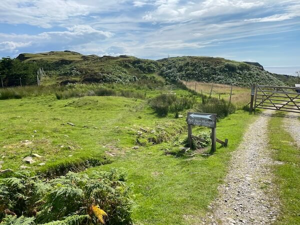
Rhu Road and Port nam Murrach Beach (Rhu Point Beach)

This can be two separate walks or you can combine them into one. The first part to Rhu old boathouse follows the one-track road from the village. Start at Arisaig Land, Sea and Island Centre and take the road next to it.
The road follows the shore of the loch much of the way and you can get a lovely view of Arisaig from the opposite side. Along the way are some small bays, tree swings and lots of sheep.
It’s a great trail for wildlife-spotting. When you get to the bend where you can see some small islands near the shore and large rocks further out, get your binoculars out to look for seals. You might be lucky enough to spot an otter but they seem quite shy.
You can also detour up some small hills through a gate on the left for some good views.


Keep following the road as it turns inland. This can be a good place to spot deer so keep your eyes open and if you have a dog, remember to keep it on a lead. Once you get to a closed gate and the old boathouse, you’ve reached the end of the first part of the trail. It’s a lovely spot to watch the sun set over Eigg.
This is where the walk to Port nam Murrach, or Rhu Point, starts. If you’ve come by car, park opposite the boathouse and go through the gate. Keep following the track until you reach a fork. Go left until you come to the next path going off to the right and you’ll see a sign pointing you to a path along a fence.
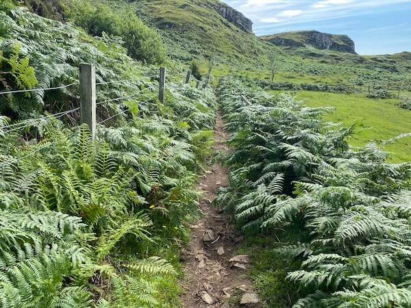
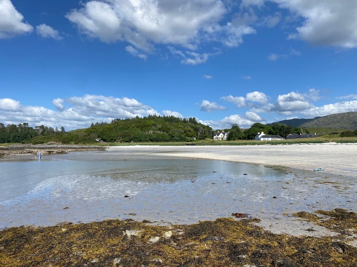
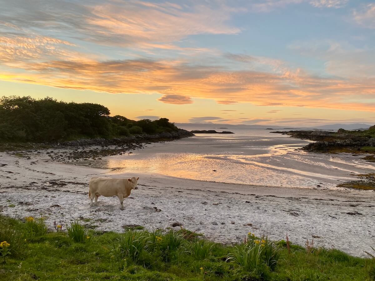
This part of the trail can be a bit wet in parts but most boggy parts can usually be avoided. It also takes you through ferns and over different surfaces. It’s easy enough to follow the path and you’ll be rewarded at the end with a two beautiful white beaches. If you’re lucky, you might meet the Galloway Belties who love Port nam Murrach Beach too!
From the village to Rhu is about 3.5 miles and would take about an hour and a half. From there to the beach is about another 1.5 miles and takes about 40 minutes.
Not sure which walk to try?
Grab the quick guide “Which Walk is right for you?’ here.
Circular Walk Arisaig

Go down the Rhu road from the village, cross the small canal and just after the cattle grid take the path on the left. Follow it round in a semi-circle past a small loch (Loch of the Swans or Loch nan Eala), through woodlands, pass through a large gate, when you get to a small crossroads, go right and continue until you come back out onto the Rhu road.

Walk back to the village to complete the loop or continue down the Rhu road to enjoy the views of Arisaig from across the water or look out for seals. On the way back, stop off where the tree swings and a bench are to enjoy the views across to Arisaig village.
This walk is about 2.5 miles and easy with no incline or rough terrain. It takes about 1-1.5 hours depending on whether you’re going for a brisk walk or a leisurely stroll.
Camusdarach Beach to Traigh Beach

When it comes to beach walks, Arisaig has quite a few but some starting or ending points may only be accessible if you’re staying on one of the beachfront camping sites. You should be able to do this one without any trouble and you may be able to do a longer one if you’re staying at Silversands.
Get to Camusdarach Car Park early to get a space. (You can also do it in reverse from the parking area at the top end of Traigh Beach.) Cross the bridge over the stream, turn right and follow the path across the dunes until it comes out on the beautiful Camusdarach Beach.
Turn left and walk along the beach and, depending on the tide, walk around or over the rocks to the next bay and then the third, where you’ll see a rocky promontory jutting further out into the sea opposite a group of rocky islands (Rubha Da Chuain on a map.)
Follow the path along the coast, go through the wooden gate near the old boathouse and continue following the worn path until it takes you onto the coastal road. (There are also a couple of parking spaces near this point.)
Walk a bit further until you can cut down onto the beach. Look out for a beaten path at the end of the beach which takes you across to the next beach and walk until Silversands campsite. (You won’t be able to continue beyond this point unless you’re staying there.)
To go back, either retrace your steps all the way, walk back along the road or retrace your steps until you see steps going up the dune near Rubha Da Chuain and follow the path back to the car park.
This walk is 2-3 miles depending on what route you take and may take one to two hours.
➡️ Click here to see more of Arisaig beaches.
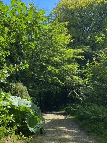
Larachmhor Gardens
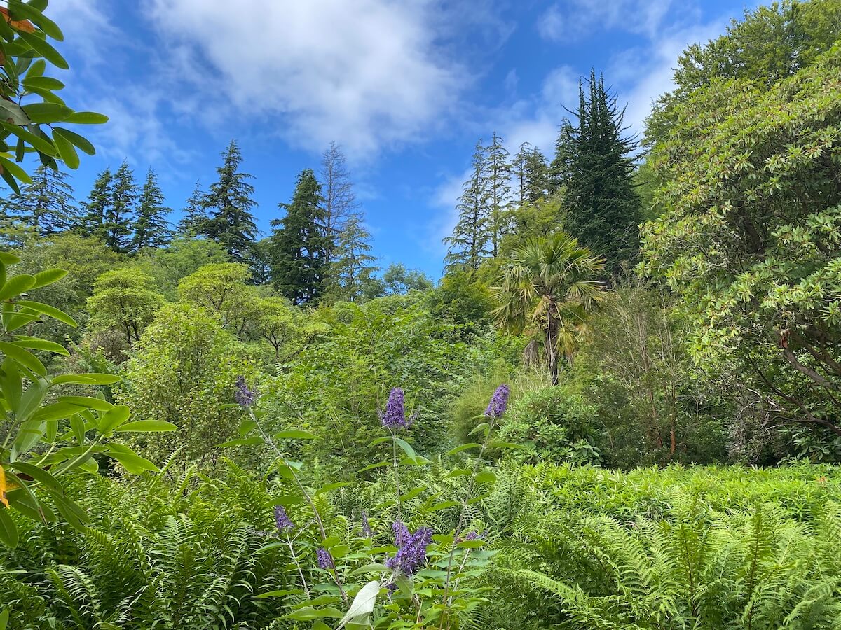
For woodland walks in Arisaig, Larachmhor Garden is a great choice. It offers a nice gentle walk and perfect for both drizzly days and hot days as the canopy of the tall trees offers protection from the elements.
The main path can be muddy so waterproof footwear helps. Smaller paths go off to the side and through small glades, copses, grasses and bushy areas.
We tend just to wander around and explore different areas like the very tall trees to the left and the exotic rhododendrons, bamboo and monkey puzzle to the right near the road side. You can expect to spend maybe half a hour to an hour here.
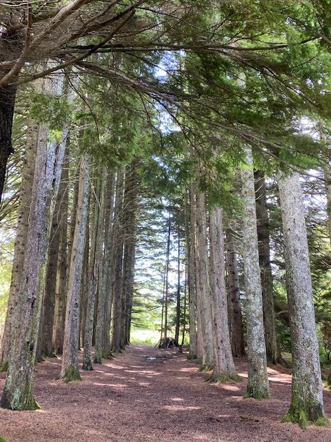
Larachmhor is a great choice for plant and flower lovers with its wide variety of plants, including many exotic ones. The rhododendrons are in bloom in May and June. See more of Larachmhor Garden here.
Coastal walk to Keppoch

The next of our walks around Arisaig is the coastal walk towards Keppoch. At the bend in the road at Arisaig Hotel, follow the smaller road and join the path along the shore or walk on the pebble beach itself. If you do that, you’ll also need to climb over some rocks.
As you continue round, follow the inland path. Eventually you’ll come to Garten and theoretically, you should be able to walk through to Back of Keppoch, however, not everyone likes to have people walking over their land so I suggest just walking round as far as you can and then turn back to return by the same route.

In the summer you can finds lots of wild flowers along the way and you’ll get a different view of Arisaig village. This is another nice one to do with young children, even if just the first part, with rocks to climb and rock pools to explore. Pick up a fishing net at Spar before you go.
Back of Keppoch
Next on our list of walks at Arisaig is the one-track lane at Back of Keppoch. This is an easy gentle walk along the road and can be started at wherever you’re staying in Arisaig. Walk along the coastal road from Portnadoran or Sunny Croft campsites or from the village, take the road past the primary school and turn left.
Look out for the sign for Back of Keppoch and follow the road down. At the end you’ll find a beach, sometimes known as Cow Bay because the cows that often like to frequent it. The public road ends here. You can walk further out along the rocks on the first promontory and, when the tide is out, you can walk out on the other side but be careful as it comes in pretty quickly.
This walk is around 2.5 miles there and back from the coastal road and takes around an hour. There is no parking there so you need to walk to that point.
Druimindarach to the Prince’s Cave

The last of our walks around Arisaig is just south of the village. I’ll confess when we went to do this walk, it started to pour and we turned back slightly defeated. It turns out we were almost at the cave! I haven’t been back since but you can buy a leaflet for the walk in Arisaig Land, Sea and Islands Centre.
To get to the start, follow the sign to Druimindarroch from the A380 and park near the old boathouse. The ground was very wet so waterproof footwear is recommended.

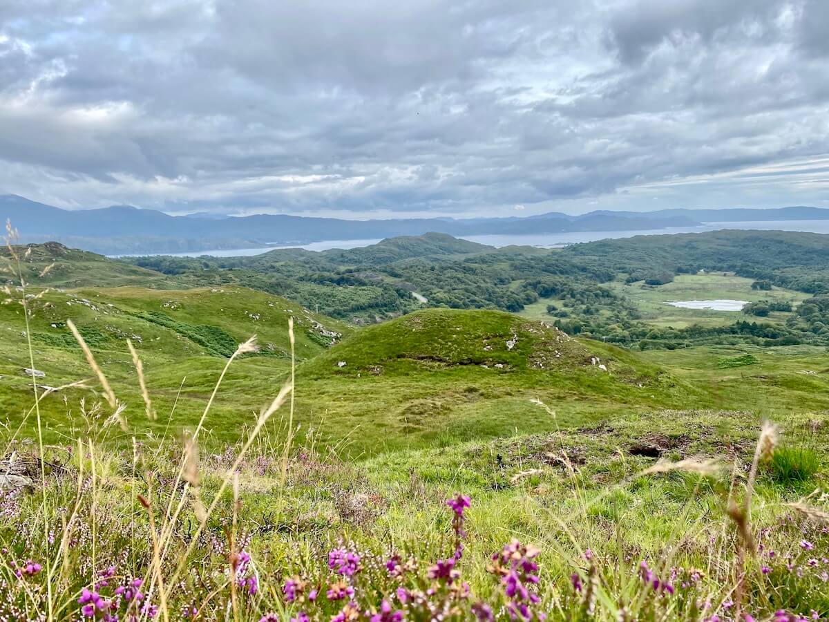
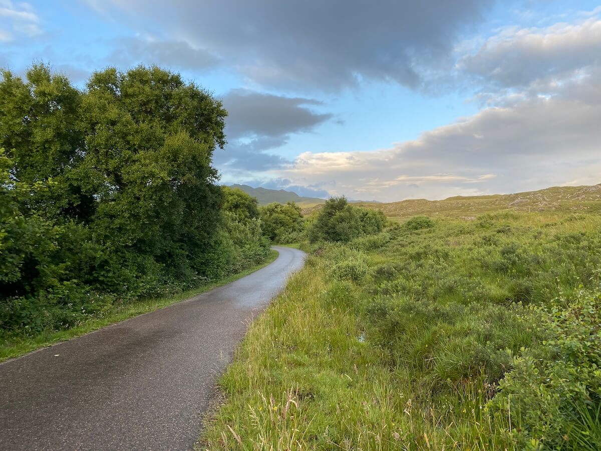
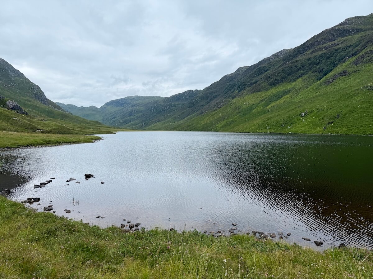
The trail is probably about 1.5 miles there and back, would take around 45-60 minutes. It includes the small Borrodale Beach and has lovely views over Loch nan Uamh. You can loop back up to the road and back down. The view above is taken on this route. A yet longer version could start at Larachmor Viaduct or the village.
Morar Walks
Loch Morar
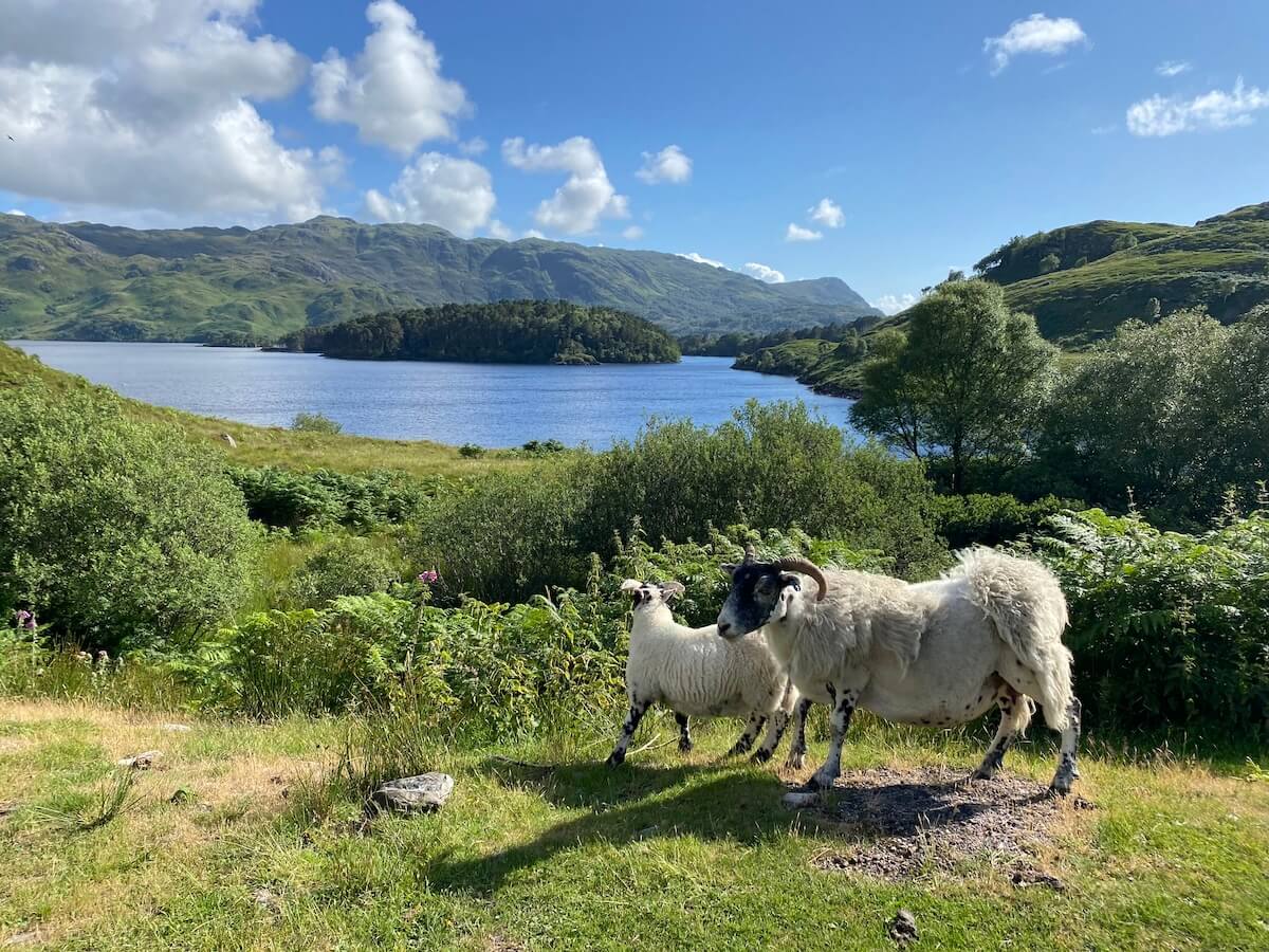
The first of our Morar walks starts at Morar Railway Station and follows the road towards Loch Morar. Just after the station, look for the path up to the Morar Cross for a great view over the Silver Sands of Morar across to Skye, Rum and Eigg. Turn 180 degrees for a view over to Loch Morar and if you time it right, you can watch the steam train pass.

Continue down the road until you get to a fork in the road. The first option is to go right and down to see the railway viaduct and walk along River Morar past the falls next to the power station and towards the loch. For a short walk, loop back on the road to Morar village. Otherwise, continue along the shore of the loch.
To skip the viaduct and the falls, go left at the fork straight to the loch. From here, follow the road to any point along the north side of the loch until it ends at Bracarina. There are small beaches and other scenic areas to stop off.
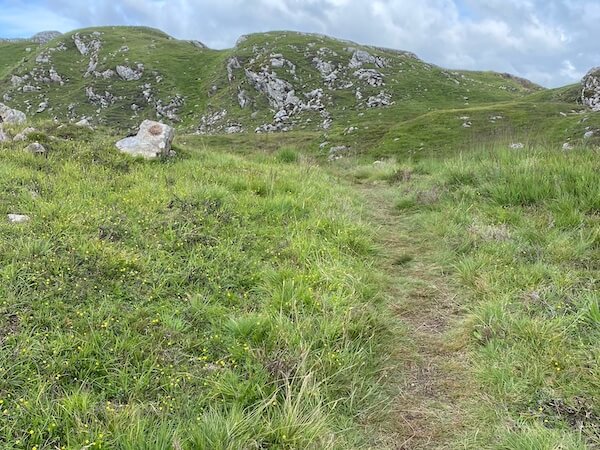
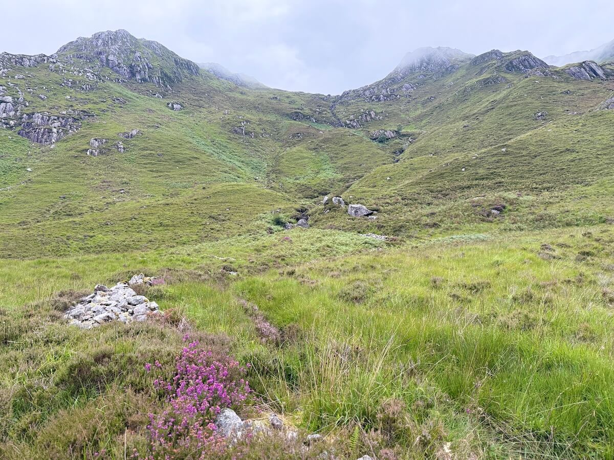
At the sign for fishing permits, you can follow the trail to Loch a’ Bhada Dharaich but you need good footwear. (See first photo below for the start.)
I started it one day but had to turn back as I only had light footwear on that day. It was quite boggy and uneven. The trail is a worn path through thick greenery and is just a couple of miles there and back.
If you walk all the way from the station to the end of the road at Bracarina (with the left turn at the fork), it’s just over three miles one way. You’ll go up and down a couple of small hills on the way and the views are gorgeous. You can continue on the next walks from the end of the road.
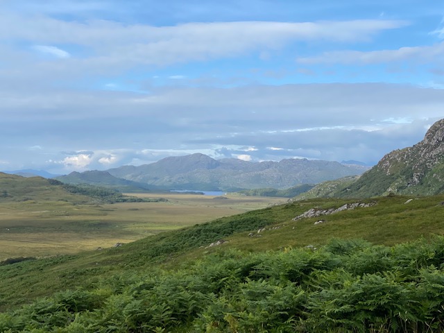
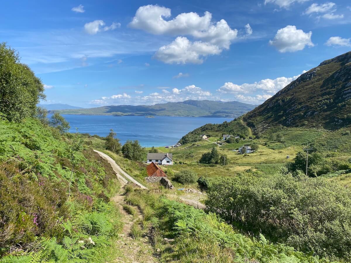
Bracarina to Inverbeg Chapel and Tarbet, Loch Nevis

From the end of the road, cross the wooden bridge and follow the path straight ahead. This path can be quite wet at the beginning but dry beyond that. Continue on the path and pass a bay with a pebble beach until you come to Inverbeg Chapel.
Beyond that you can continue as far as you like, passing burns and waterfalls, and turn back or carry on until you pass Swordlands and turn to the left across to Tarbet on Loch Nevis. Next, the options are to turn back the same way or take the ferry to Inverie, Knoydart and on to Mallaig.

You must pre-book the ferry or there is no guarantee it will come if there are no bookings or passengers from Inverie. Read about what you can do on Knoydart.
The walk from Bracara to Tarbert is varied from clear wide paths to a few rocky trails to woodland. The trail is around 5.5 miles one-way and takes around 3 hours. See more of Bracarina to Tarbet.
Bracara to Stoul

I haven’t completed this trail but the first part offers lovely views over Loch Morar. It starts on the left straight after the wooden bridge and goes uphill, then continues past two lochs until reaching the old village of Stoul on Loch Nevis. Look out for roe deer along the way. We spotted them watching us through the trees.
There are more ascents and descents than on the Tarbet route but this allows for more panoramic views. However, it seems that the descent and ascent to the village is pretty steep so you may want to stop before going down. (I will anyway!) Hopefully I’ll update this soon once I’ve done it.
This is a one-way route and is about 5-6 miles there and back. It’s more challenging than the other Loch Morar walks. See more of the walks at Loch Morar here.
If you’re planning to go on the longer walks or off the road at all, Ordnance Survey has a map that covers Morar. You can buy the paper map of Loch Morar and Mallaig (OS Explorer 398).
Silver Sands of Morar Walks

For something short and gentle, take a walk along the stunning Silver Sands of Morar. You should time this for when the tide has just gone out to get the best walk. For the first walk, start at Morar Beach or from the car park, take the path down the hillside onto the next part of beach. (If the tide is in, these areas are separated.)
Just head out as far as you can go either along the dry sand or head straight across to the top of the bay. For this, you’ll walk in shallow water, so either go barefoot or wear something suitable (or just get your shoes wet!)
As that side of the river tends to be the most popular, the other side is usually quieter. After you pass the main bridge on the A380 over the River Morar heading towards Mallaig, look out for the parking places on the left.


From there, take the steps down to the beach and go right to walk round as far as you can go. If the tide is out, you should be able to get to a small beach. Then, turn back and walk up towards the bridge. From the steps to the bridge and back is just under a mile and to the small beach is probably only about 0.6 miles there and back.
Mallaig Walks
Circular Walk Mallaig
The Circular Walk in Mallaig starts from the east side of the harbour. The starting point is soon after the beginning of East Bay Car Park. The sign isn’t that easy to spot so look out for it between the first few buildings.
The trail takes you up the hillside between and behind these buildings and the first bit is a little steep but keep going as it soon gets easier and it’s worth it for the views.
The path then takes you up a more gentle incline and across towards the single track road that runs high above the coast looking over to Skye, the Knoydart Peninsula and Loch Nevis.
You’ll notice a signpost to join the Loch an Nostarie trail if you want a longer walk. It comes out at Glasnacardoch on the old Mallaig road. It’s generally wetter than the circular walk though as you get near the loch. See more below.
Near the top, you can also detour to the left to get great views over Mallaig Harbour. See a longer version of this trail on Wikiloc.

Once you reach the road, turn left and follow it back down to Mallaig Bheag and back down to the East Bay. Stop off at Mallaig Viewpoint, enjoy the view and read about the places you can see and marine life.
As you walk back along the harbour, look out for the resident seal. You’ll usually see her if you wait long enough.
Loch an Nostarie and Loch Eireagoraidh

Next, we have three options of Mallaig walks starting at Glasnacardoch on the old Mallaig road. You’ll see Glasnacardoch signposted from the new road before you enter Mallaig. Just beyond the start of the trail is a small clearing where you can park.
Follow the signs towards Loch an Nostarie and stop to enjoy this viewpoint. From here, you can turn back, continue further and left towards the coast or continue straight towards Loch Eireagoraidh.
This first section is the easiest of the Mallaig walks if you have young children and you’ll see lots of wildflowers along the way in the summer. This part is about a mile and a half there and back and takes around 45 minutes.
To continue, keep following the path, although it becomes much less worn and clear beyond this. It also gets pretty boggy and marshy so I recommend waterproof footwear if you plan to continue beyond the viewpoint. The terrain also gets rougher.
For the second option, almost at the end of the left side of the loch (as in the photo), you turn up a hill and eventually meet the Mallaig Circular Path. Follow it back round through Mallaig Bheag to the harbour.
If you parked your car at Glasnacardoch, keep following the road, turn left up the hill at The Cornerstone, continue through the village, stopping at the top for the view and continue back to the parking place. The full loop is just under five miles and generally takes 2.5-3 hours.

An alternative and slightly shorter route is going back down the hill on the Mallaig Circular Walk to the harbour to the starting point rather than joining the road that goes along the coast. To do this in reverse, see the information on Mallaig Circular Walk then follow the sign to Loch an Nostarie.
For the third option to Loch Eireagoraidh, keep following the path past the turn up to the Circular walk. Continue straight following the red markers and go up the hill. This route is a one-way trail of around 4.5 miles there and back and takes 3.5-4.5 hours.
It can be useful to use an app like Wikiloc or All Trails for the longer options as I found the trail wasn’t that easy to follow. (They may have been upgraded since then though and it may just have been me!) See the last two trails combined on this Wikiloc trail. You can also follow this trail for Loch Eireagoraidh only and continue along Loch an Nostarie on the way back.
Other walks around Arisaig
Loch Mama
This walk is around 7 miles south of Arisaig and is about 4 miles there and back. It’s a moderate trail with varied terrain, including some stone-hopping across the river, rough tracks and lightly worn paths. It’s not suitable for anyone with mobility issues and I wouldn’t recommend doing it for young children.
Waterproof boots are essential as there’s quite a lot of marshland and bogs to cross as well as crossing the water at some points. (I’d recommend boots with ankle support too.)
The trail up Glen Mama starts at the side road leading to a croft shortly after Loch nan Uamh Viaduct (coming from Arisaig). There are a couple of places to park in front of disused gates between the viaduct and the side road.
Head down the road until you see a wooden bridge to your right. Cross the bridge, turn left and follow the river (Allt a’ Mhama) You’ll see a faint trodden path as you reach the grassy area and will soon after need to cross the water across stones and then follow the path along the river. At some points the path is clear and at other, just faint. Occasionally, there seem to be two paths but they’ll meet up shortly. It also veers away from the river.
When the path takes you back to the river facing you, don’t cross, go left along the path, keeping the river on your right. Keep going and pass the stone ruins on your left. You may see two faint paths – follow the one heading towards the glen, slightly to the right. The path is very faint here, the terrain is very marshy and foliage is thick and further along, you’ll pass small burns that aren’t always obvious, so stay alert and keep an eye on the ground ahead.
The path will take you back along the riverside and before long, you’ll reach Loch Mama. Once you reach the loch, you’ll have three options – return on the same trail, go around the loch and cross back over to the path at the beginning of the river, or continue along Loch na Creige Duibhe. I haven’t done either of the last two so can’t comment further.
Although the walk is a short distance, two miles each way, the terrain means it can take longer than expected. It took me about an hour and 45 minutes to reach the middle of the loch with stops along the way and about an hour to get back.
You’ll see lots of flora along the way and there’s a good variety of birds too.
Here are a few links to other walks not covered above.
- Glen Beasdale, moderate, 3.3 miles, boggy path, starts near Beasdale train station
- Peanmeanach Beach, moderate, 3.7 miles, hills and boggy, starts next to A830
- Bourblach Beach, easy, 1.5 miles, starts near the A830 at Morar
Tips to make your walks around Arisaig safe
Tide – The tide can come in quickly. If you’re taking a walk on the beach or you go out to rocky isles, keep an eye on the tide as it’s easy to get stranded. (Yes, done that 🙄)
Ticks – Long trousers and socks can help avoiding ticks when walking on the hills or woodlands in the summer months (late March onwards), however they may not prevent getting them altogether. They also protect against nettles, grasses, etc. You should still check daily for ticks even after just going to the beach. Don’t panic if you find one, just remove it safely, and monitor for any red rings or anything unusual. See more on ticks here.
Weather – If you’re going off into the hills, check the weather forecast for rain and keep an eye on the sky as mist can fall very quickly. Following a trail or recording your own helps avoid getting lost in low cloud or mist (or in any weather). I use Wikiloc. Or go old school and pack a map and compass, especially if you’re going far.
Clothing – As well as long trousers, long sleeves and a hat can protect against midge bites if you’re going into ferny areas. When the sun is out, it can be quite intense even if the temperature is low so a hat is good for that too. A lot of walks can be wet either from burns (streams), bogs or marsh so waterproof footwear is ideal and ankle support is good for uneven terrain. When mist falls, it can turn cold fairly quickly so pack an extra layer and/or a waterproof layer if you’re going hill-walking.
Check your footing – If you’re not used to walking on boggy and marshy ground, get into the habit of checking your footing when stepping on tufts and rocks before putting your full weight on them. If you’re walking with a group, it can be easier for one person to lead and the others to follow in their footsteps (literally), especially with children.
Let someone know – If you’re going off the beaten track, let someone know where you’re going and what time you expect to be back. Charge your phone up and take a fully-charged powerbank and cable, especially if you’re taking photos or using apps.
Dogs – There are lots of sheep and deer around so please keep them safe by keeping your dogs on a lead. Check your dog for ticks before getting in the car. And of course, don’t forget poop bags to keep the path clean and safe. See more on dog-friendly Arisaig, Morar and Mallaig.
Pack a rucksack – If you’re going for more than a gentle stroll, take a backpack with water, snacks, waterproof layer, binoculars and powerbank. You might also need a map, mini first aid kit, tick remover and insect repellant. (I sometimes even have a spare light pair of shoes.)
Maps – Pop in to the Arisaig Land, Sea and Island Centre to buy individual leaflets of walks or Ordinance Survey maps. Download the Highland Council booklet below. Use All Trails or Wikiloc apps to record or follow a trail. Buy OS Maps online or subscribe to the OS app and download maps before starting in case you lose signal or want to turn it off.
Wrap-up on Arisaig Walks
As we wrap up this guide to some of the best walks around Arisaig, Morar, and Mallaig, I hope you feel inspired to go off and explore these stunning landscapes for yourself.
When I walk these trails, I feel each one has its own unique blend of beauty and tranquility, whether it’s the soft sands of the white beaches, the hidden woodlands, the shores of tranquil lochs or the rugged hilltops and I’m sure you will too.
Whether you’re looking for an easy stroll to rejuvenate or a more challenging hike, there’s something here for everyone and whichever one you choose, you can always be assured of beautiful views.
Before you set out, don’t forget to pop in to the Arisaig Land, Sea and Island Centre to get your maps of walks and check out the additional resources and maps provided at the end of this post and to click through to the links within the post to see more of the beautiful area and fabulous things to do.
Happy walking! Let each trail lead you to unforgettable views, new discoveries and ever-lasting memories!
What to read next after Arisaig Walks? Arisaig Beaches or 39 Best Things to do in Arisaig or Best Things to Do in Mallaig.
Click here to download your quick guide to choosing which walk is right for you.
Useful Links
Download All Trails app – use my referral link and they’ll plant two trees, one for you and one for me!
Buy OS Explorer Map 398 of Loch Morar and Mallaig or subscribe to the Ordnance Survey app.
For maps for most of these walks, you can download the handy Highland Council guide to walks in the area (see below) or pop in to the Arisaig Land, Sea and Island centre where you can buy them and support the Arisaig Community Trust.
You can also download/open the file directly from The Highland Council website here. Different formats and languages are available upon request.
📱Follow on Instagram or Facebook to see more photos, videos, tips and snippets of information
🗞️ Join Everything Arisaig mailing list for notifications of new posts, products and occasional news.
📘 Get your digital guide to Arisaig, Morar and Mallaig here.
🌐 Go to Home or About to know more about Everything Arisaig or see all posts here.