Maps of Arisaig, Morar, Mallaig and Beyond
This page includes the maps and legends from my guidebook Exploring Arisaig, Morar and Mallaig, making it easy to refer back while planning your trip or while you’re on the go. You’ll find village maps and wider area overviews, with symbols highlighting beaches, walks, places to eat and more.
It also features an embedded interactive Google My Map showing a broader view of the area. You can zoom in and out, click on locations for photos and links to relevant posts, and – on many devices – download it for offline use.
Note: This page isn’t currently listed on the main site, so please bookmark it now if you’d like to return to it later.
I’ll be adding more map-based content in the future, so don’t forget to check back now and then.
Disclosure: When you make a booking or purchase through selected links on this site, I may earn commission from partners at no extra cost to you. This helps me to build the site and bring you more useful posts! Such links do not include local businesses.
If you haven’t bought the Guide to Arisaig, Morar and Mallaig yet but would like to or to see more, head over here.
Interactive Map: Arisaig, Mallaig, Morar and Beyond
This interactive map shows key locations across Arisaig, Morar, Mallaig and nearby areas. Click on pins for photos, links and extra details or open the map in a new tab for a full-screen view. You can also download it for offline use on many devices.
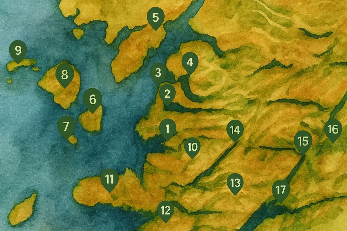
Wider Area Map- Lochaber
This map shows the broader Lochaber area with key locations mentioned in the Exploring Arisaig, Mallaig and Morar guide book. Some areas of Lochaber which are not mentioned in the guide are not included, such as Ballachulish, Glencoe and Rannoch Moor. You can see more on some of these at Great Places to Stop on the Way to Mallaig.
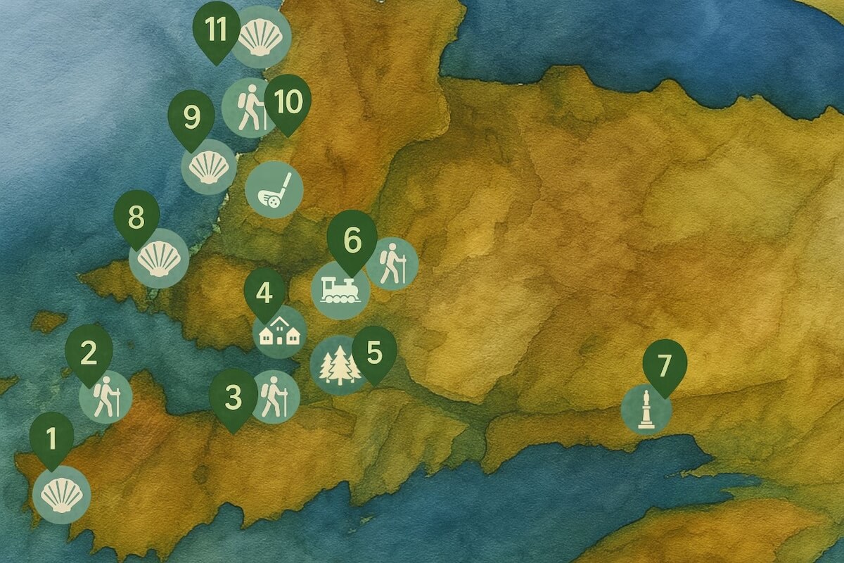
Arisaig Area Map
Use this map for a general overview of Arisaig and nearby beaches, walking routes and viewpoints. For a detailed view of the village, see the map further down.
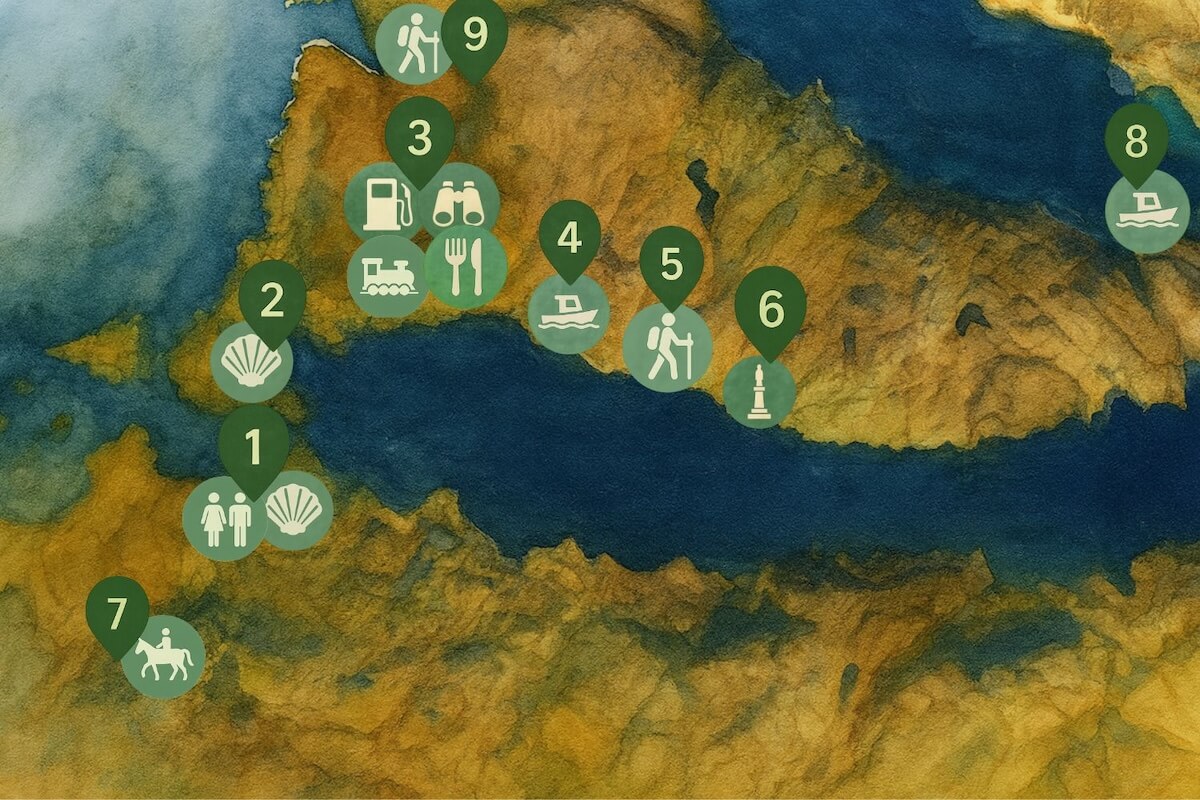
Morar Area Map
This map focuses on Morar village, Loch Morar and the surrounding areas, including beaches, walking trails and scenic viewpoints. (I included the walking trails in point 9 here as it didn’t fit on the Mallaig map.)
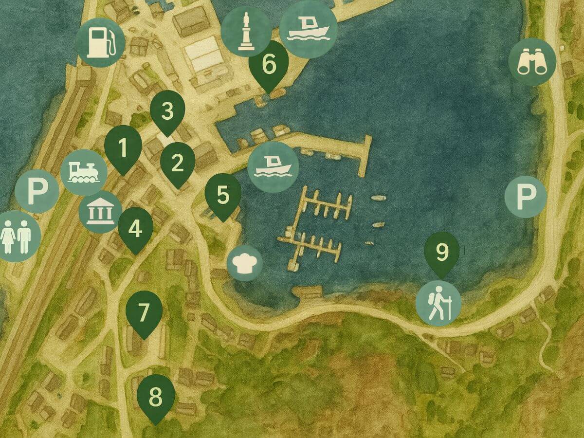
Mallaig Village Map
This village map highlights places to eat, attractions and shops in Mallaig. As many of the restaurants, shops and tourist spots are close together, I’ve grouped them into numbered areas on the map. You’ll find the names listed under each number in the key.
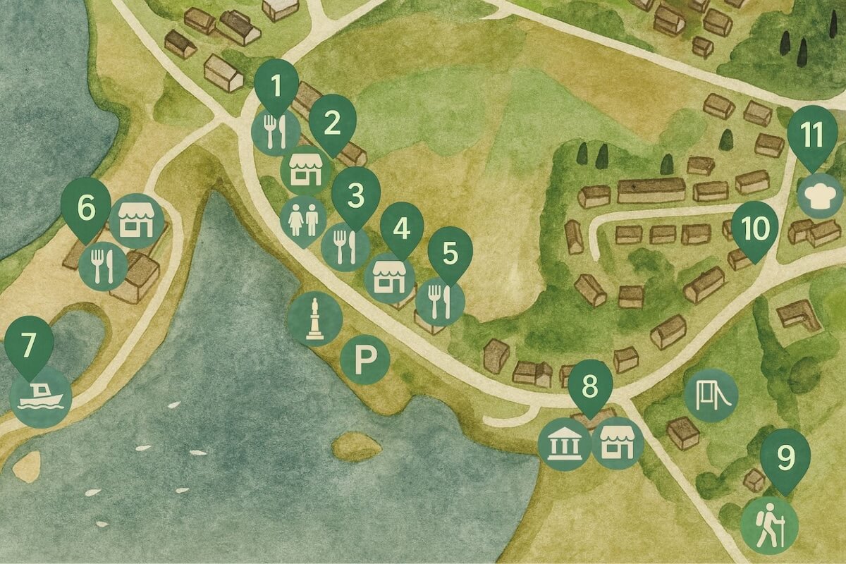
Arisaig Village Map
This map shows the layout of the main area of Arisaig village, including places to eat, shops and attractions.
Before You Go…
I’ll be updating this page over time with more map-based content, including walking routes and new finds. If you found it helpful, bookmark it now so you can refer back later – or share it with others planning a trip.
For even more walks, local tips and travel inspiration, check out the Exploring Arisaig, Morar and Mallaig guidebook, your companion to slow travel in this stunning part of the West Highlands.
To explore further, read these popular posts:
- Best Walks in Arisaig, Morar and Mallaig
- Ultimate Guide to Boat Trips from Mallaig and Arisaig
- Best Things to Do in Mallaig
- Best Things to Do on a Day Trip to the Isle of Skye
- Alternative to the Jacobite Steam Train
To get the full guide, you can buy and download it on Payhip by clicking here or you can buy it on Amazon Kindle by clciking here.
📱Follow on Instagram or Facebook to see more photos, videos, tips and snippets of information
🗞️ Join Everything Arisaig mailing list for notifications of new posts, products and occasional news.
📘 Get your digital guide to Arisaig, Morar and Mallaig here.
🌐 Go to Home or About to know more about Everything Arisaig or see all posts here.